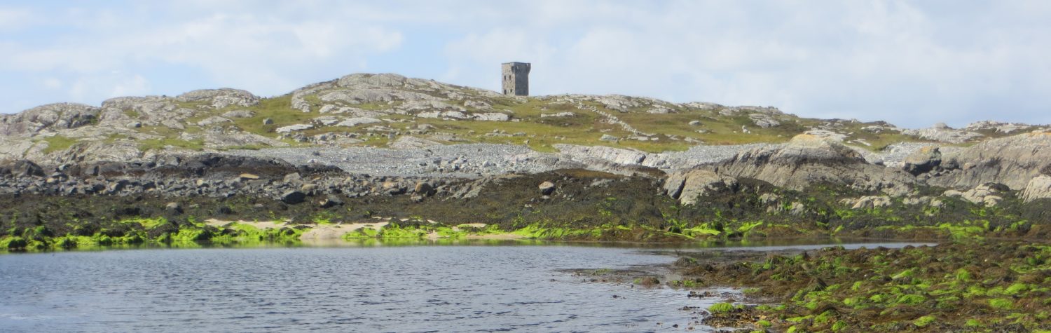


Shivel Head Signal Station is located at the very west of Clare Island at 143m OD, on the western flank of Knockmore. It has clear views to the north, west and south but the view to the east is blocked by the mass of Knockmore. The adjacent signal stations on Saddle Hill to the north and Inishturk to the south are clearly visible from the site. The site is accessed by following the main road all the way to its western end of the island and then heading onto the boggy ground to the north west. The signal station consists of a partially collapsed signal tower set within an almost square enclosure. A lime kiln is located in the south west of the enclosure and a small sub-circular foundation, that may belong to a later hut is located due west of the signal tower.

The signal tower consists of the semi-basement level, the ground floor and some fragments of the first floor. Apparently the tower was largely complete until 1989 when high winds caused the upper portions to fall. The site is surrounded by a substantial spread of collapse and the large concentration of stones to the east indicate the tower largely fell in that direction.
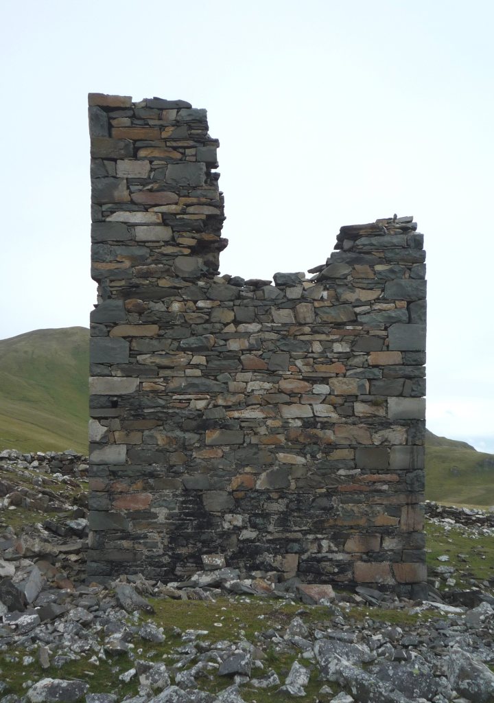
The signal tower had windows on the northern and southern walls and the first floor doorway on the west. It is assumed that bartizans were located on the corners of the eastern wall and that a machicolation protected the doorway on the first floor, although none of these features are now visible.
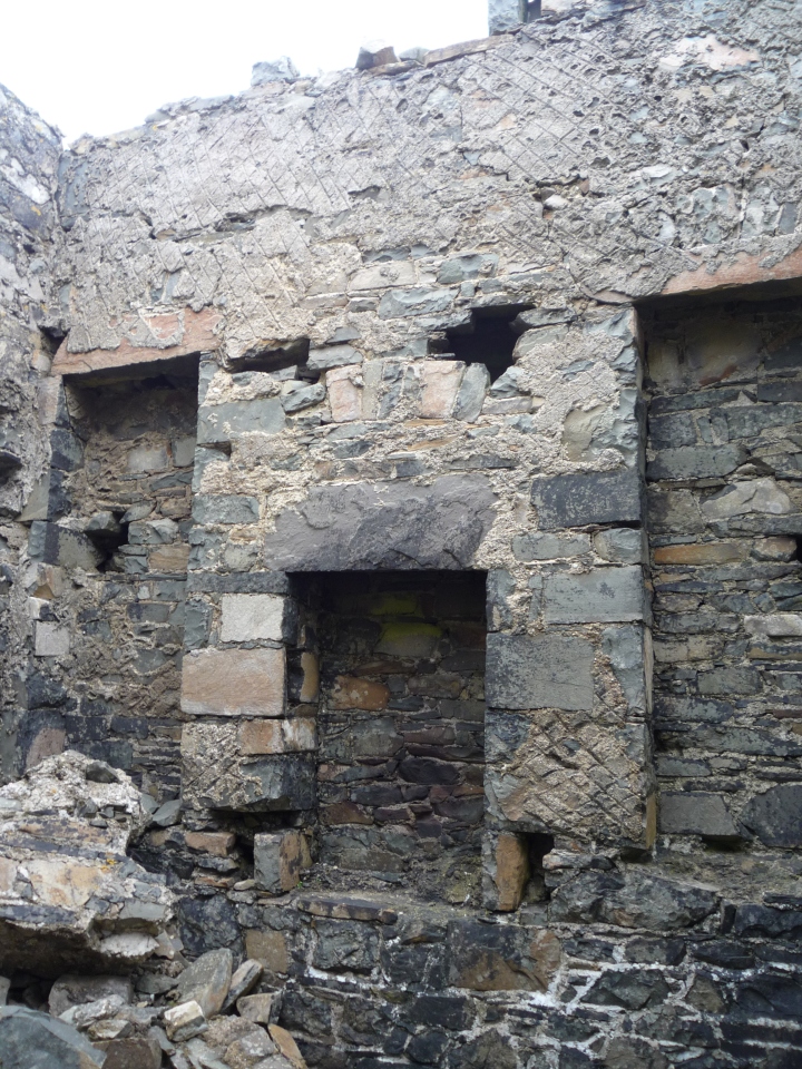
Inside the building all of the internal features are present as expected on the surviving parts of the building, with the exception of the slots and joists that would have supported a split mezzanine level between the ground floor and first floor. A series of holes in the western wall below the doorway and on the eastern wall at the height of the tops of the alcoves might represent a variation on these features, but they may simply represent damage to the structure. A semi-basement is clearly visible as are parts of the ground floor windows and the fireplace with its flanking alcoves. The base of the first floor windows are visible on the north wall and the base of the first floor fireplace can be seen on the eastern wall.

The signal station is set within an almost square enclosure defined by a largely collapsed stone wall, but which was clearly quite a considerable barrier based on the surviving elements. Interestingly parts of the western side of the enclosure are defined by a natural rock outcrop and no actual wall was constructed in those areas. The enclosure measures around 22m by 26m.

In the south west of the enclosure, approximately 10m from the signal tower, there is a large lime kiln. This is very similar to the example at Inish Turk Signal Station with the same bowl shaped form, but its condition is not in quite as good. The lime kiln would have been used during the construction of the signal station in the manufacture of mortar and render. A low rectangular foundation is located approximately 6m west of the signal tower which appears to be the remains of a small hut measuring 4.3m by 3.6m externally and 3.1m by 1.75m internally. It is not clear if this is a contemporary element of the signal station or a later construction.

2 thoughts on “Shivel Head Signal Station, County Mayo”